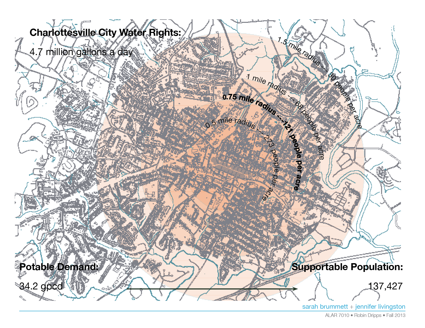
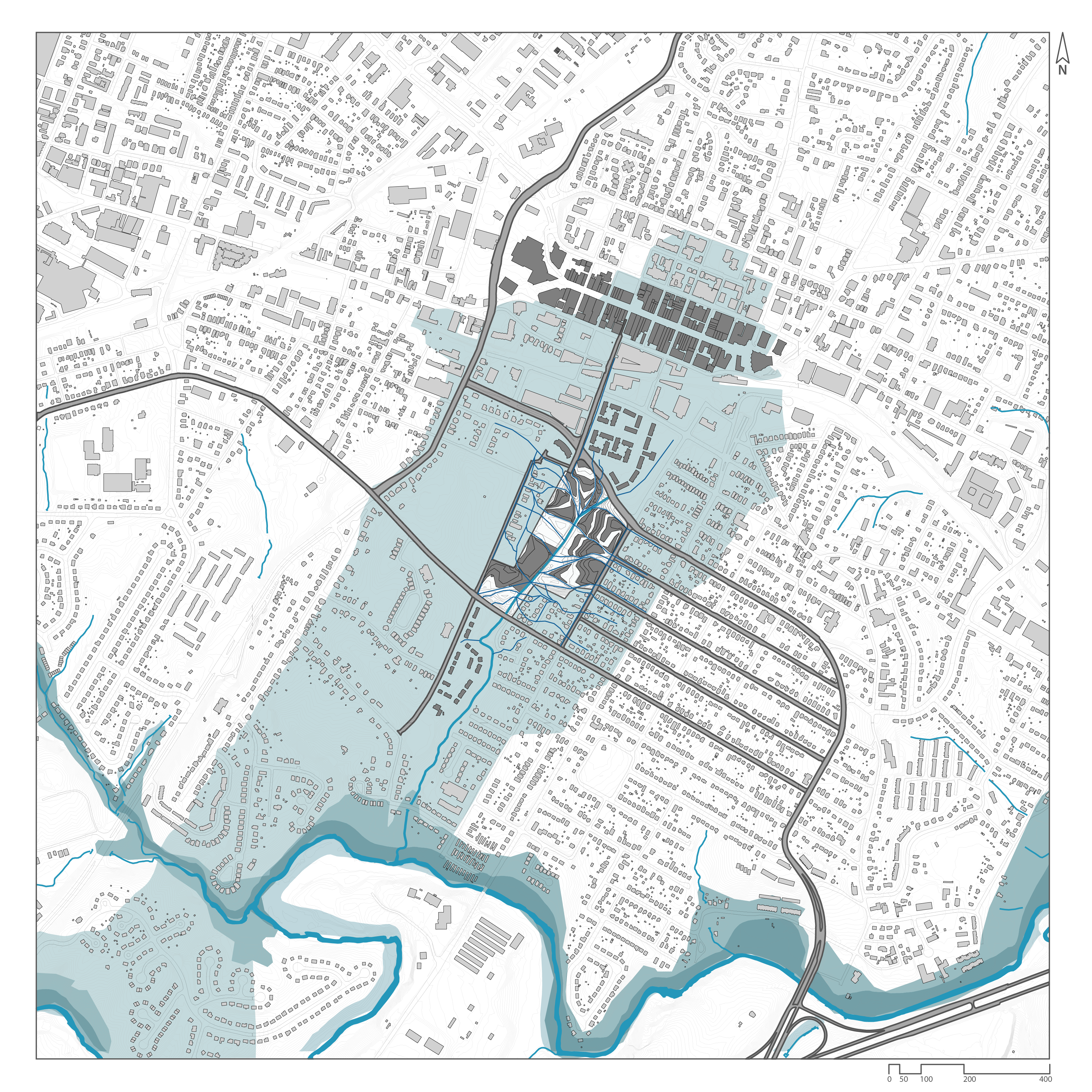
This project defined architectural and landscape form through analyzing the intersection of population growth, increased urban density, and water in Charlottesville, VA.
Partner: Jennifer Livingston, MLA Candidate 2015
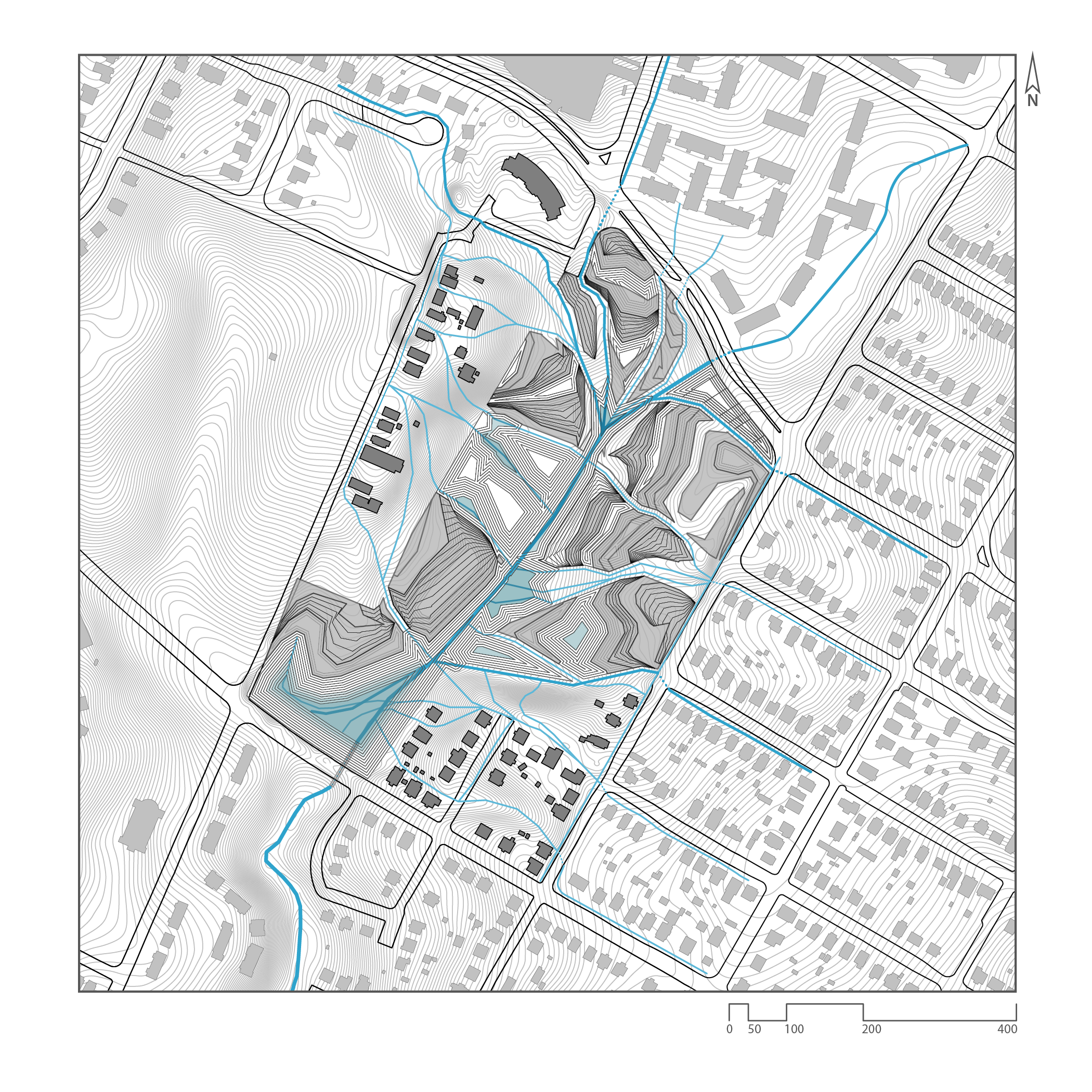
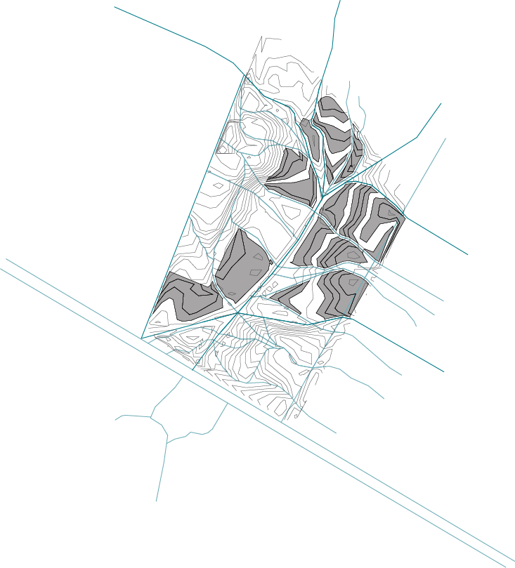
Local Watershed:
From landscape to architecture:
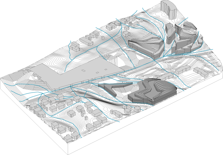
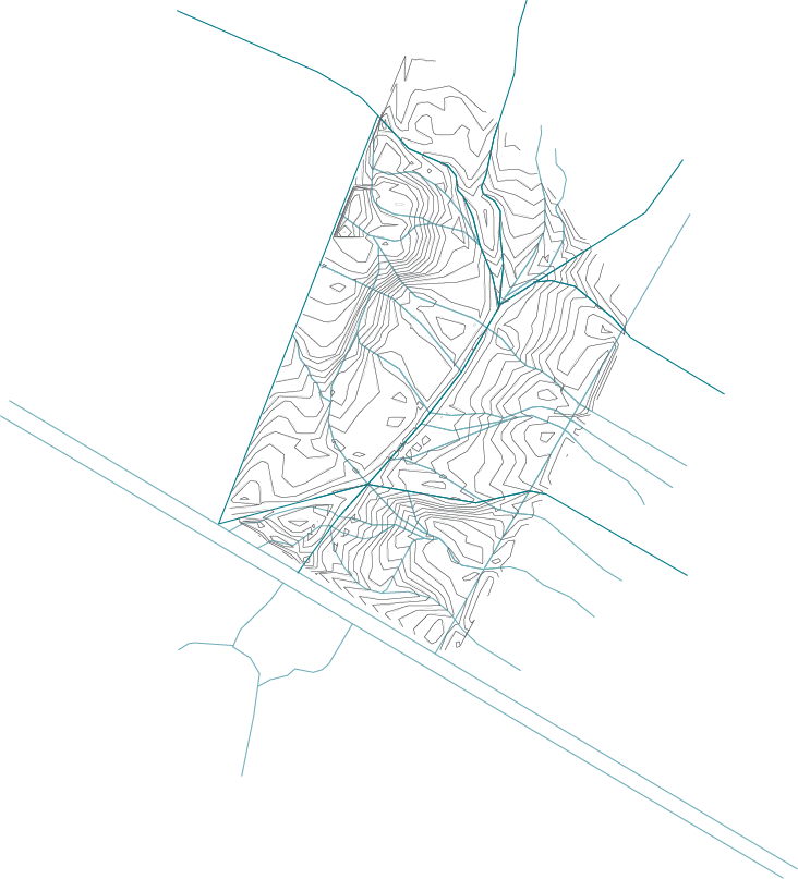
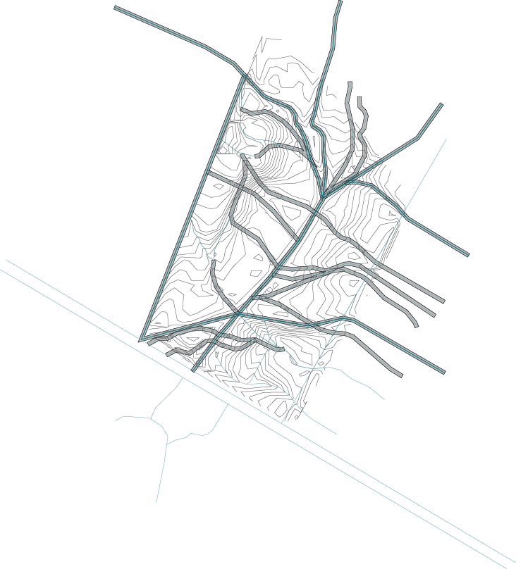
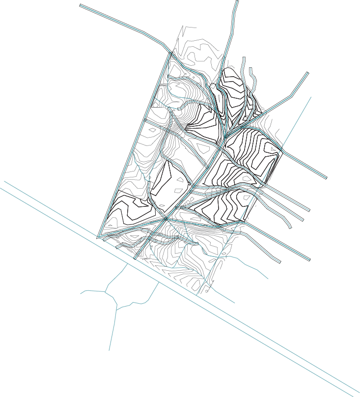
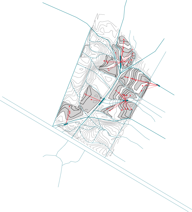
1. Restore site stream and swale system2. Simplify swale paths3. Establish swale corridors for circulation4. Establish plan through intersection of topography and drainage5. Cull segmented topography to create internal circulation and courtyards6. Evaluate distance from selected swale segments
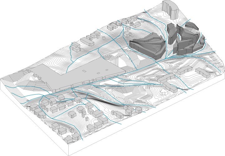
Site Process:
Existing site condition1. Establish a system to daylight existing storm drainage infrastructure2. Construct new topography and surface storm infrastructure using bioswales and a constructed wetland
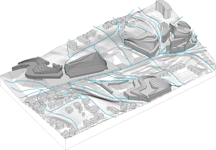
Extrude segmented topography based on distance evaluation to create habitable space:
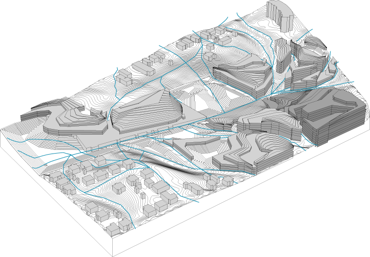
Phase 1Phase 2Phase 3Phase 4
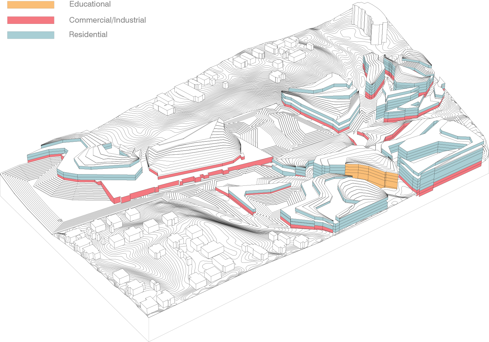
Program Breakdown:
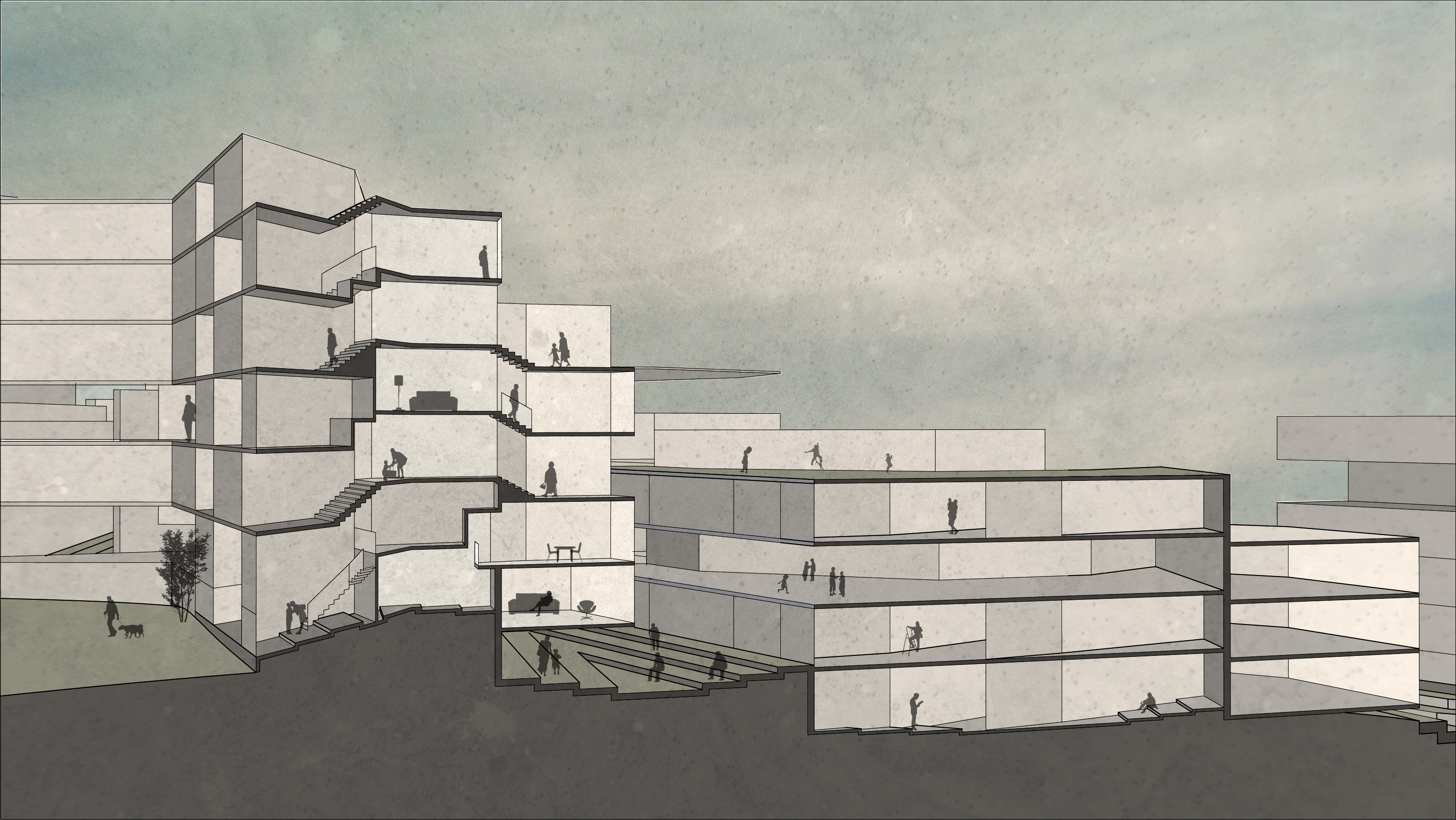
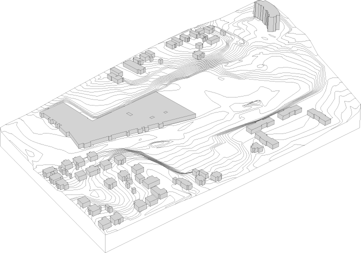
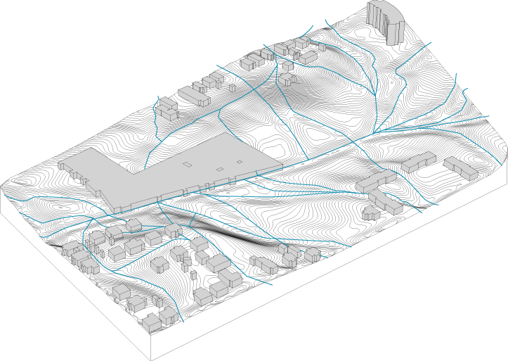
Final Site PlanResidential SectionSite + Program Model


![Axon5 [Converted]](https://sarahebrummett.com/wp-content/uploads/2014/04/axon5-converted.png)